
Present Day
(Present day) 1868/71-->
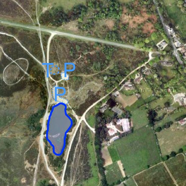
| Present Day aerial photo used as background for all the maps. The pond area is outlined. "P" marks the car park areas and "T" marks the prehistoric burial mound. |
(View Index Page)
(to close this window, click on the main window, or use the "close" button on your browser)