
1868/71
<--Present Day (1868/71) 1897/98-->
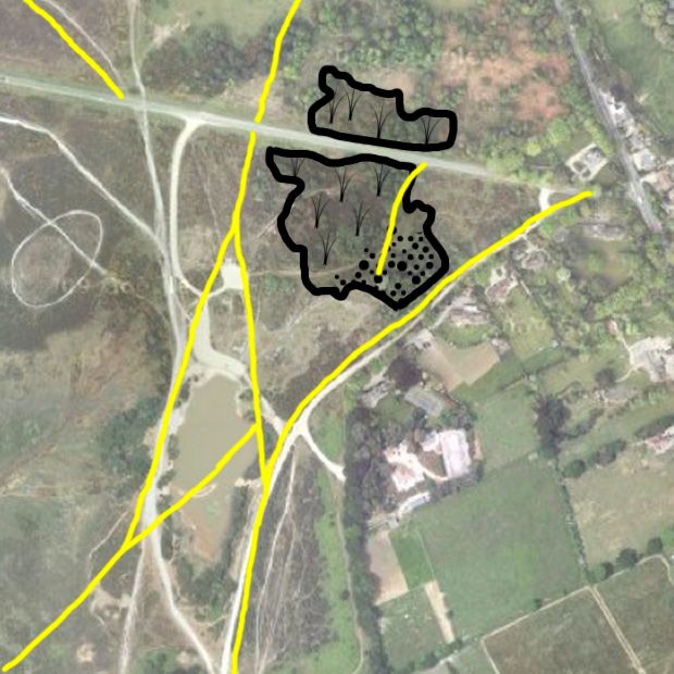
| The position of the gravel pit as marked on the 1868/71 Ordnance Survey maps. Tracks shown on the maps are marked in yellow. By 1868 much of the pit area appears to have been overgrown but the southeast region may still have been in use (stippled). Possibly the pit was originally created during the construction of the nearby Brockenhurst to Lymington railway (opened 1858), or it may date to earlier years. The area of the present day pond was open heathland. |
(View Index Page)
(to close this window, click on the main window, or use the "close" button on your browser)