About Setley Pond - Introduction
Setley Pond (click for directions) occupies the southernmost extension (created during the World War 2) of a gravel pit dating to Victorian times or earlier which covered the area of the present day car parks and land northwards towards the road.
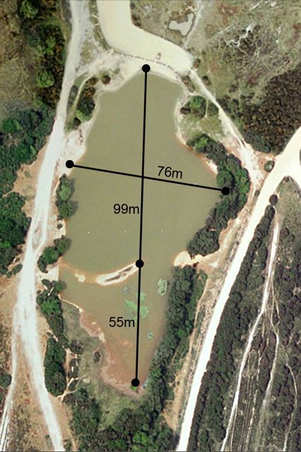
The part of the pond which is used for model boating extends from the car park southwards to the "island", a distance of about 100m. The shallower water beyond the island is a haven for the New Forest animals and birds including the pond's herons. It extends a further 50m if the pond is "full" but dries out when the water level is low.
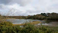
 The photo (top left) is a view looking northwards towards the car park following a dry summer (2011) when most of the region south of the island had dried out.
 The depth of the pond varies between about 1m to 2m or more depending on how full the pond is. Most of the bottom of the pond is level and covered by about 30cm of mud, however there is a deeper region south of the planks on the western bank.
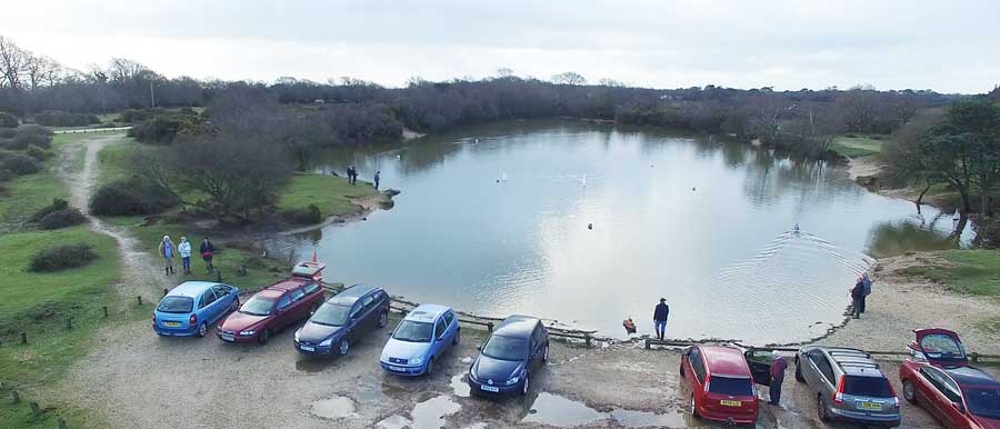
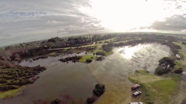
The image above left shows the pond in January 2016. Click on it to view a short video showing an aerial view of Setley Pond and the surrounding countryside at that time. The image on the right shows the pond in January 2014 when it had flooded across the car park and over much of the area of the old gravel pit; again click on the image for a video shoing the pond in flood! [videos: 2016 - Oliver Hill; 2014 - Jonathan of LPB Productions].
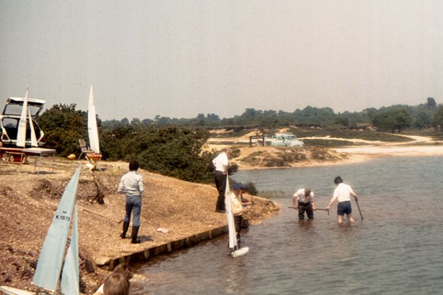
 When the pond was adopted for model boating in the 1970's a JCB type mechanical digger was used to level the pond bottom, creating the "island", and a launching "quay" was formed behind wooden planks along part of the west bank (see photo). Comparison of the pond "then and now" shows that there is now much more undergrowth and trees along the banks nowadays.
A famous local landmark Sway Tower can be seen from the path running around the pond.
|